OMEGA ENGINEERS, INC. provides comprehensive Hydrologic and Hydraulic studies and system design (H&H) services for infrastructure and land development projects. Study services provided include: 2D analysis, flood plain mapping, bridge and culvert hydraulics, riverine hydraulics, dam break analysis, scour analysis, sediment transport analysis, regional and local storm water impact and mitigation analysis, urban storm water management and master planning. Hydrologic studies and design are performed utilizing a complete suite of software applications.
- HEC RAS 1D/2D
- HEC-HMS
- MIKE URBAN
- XPSWMM 1D/2D
- Flo 2D
- ArcGIS
- ARC-HYDRO
- HEC-GeoHMS
- HEC-GeoRAS
- INFOWORKS
- HY-8
- STORMCAD
- GEOPAK DRAINAGE
- ArcGIS
- GEOPAK
- Autodesk Civil 3D
Representative Services
- Storm Water Management
- Hydrology and Hydraulic Modeling and Analysis
- Watershed Study and Master Drainage Plan
- Drainage and Detention Design for Commercial and Residential Developments
- Highway and Roadway Drainage and Mitigation Design
- Water Supply and Waste Water System Design
- Erosion and Sediment Control
- NPDES/MS4
- Stormwater Utility
- Drainage Master Planning
- Dam and Reservoir Safety Assessment and Environmental Evaluation
- Bridge Hydraulics and Scour Analysis
- FEMA NFIP Flood Studies (including LOMR, CLOMR, LOMA, and LOMR-F)
- Floodway No Impact Analysis and Certification
- Hazard Mitigation Planning
- Bridge and Culvert Hydraulics
- Channel Improvements
- Storm Sewer and Culvert Design
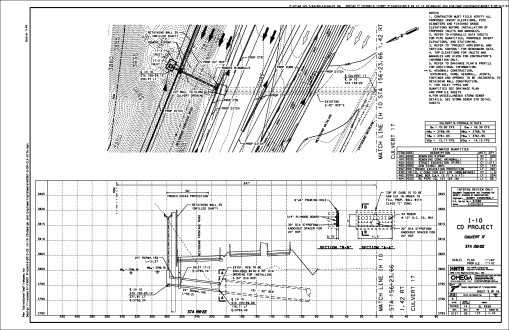
- IH-10 COLLECTOR AND DISTRIBUTOR LANES - Executive Center Blvd and Sunland Park Drive
Client: HNTB, (TxDOT El Paso District)
OMEGA developed a single comprehensive drainage study and PS&E drainage design for IH-10 improvements on the West Side of the City of El Paso that includes the building of new frontage roads along IH-10, new collector-distributor lanes that will run parallel to IH-10 from Mesa Street to Executive Center Boulevard, and the replacement of Resler Dr. and Sunland Park Dr. direct connectors. OMEGA performed all hydrology and hydraulics studies and engineering for the project, including bridge hydraulics, scour analysis, inline detention and retention mitigation, culvert layouts, storm sewer and bridge deck drainage design, an impact study for Keystone Dam, FEMA floodplain mitigation, and broken back culvert analysis. OMEGA coordinated with City of El Paso (floodplain administrator), El Paso Water Utilities (EPWU), FEMA, Corp of Engineers, and International Boundary and Water Commission (IBWC). OMEGA also developed preliminary roadway profiles and profiles of natural ground along each proposed grade line of the roadway to identify impacts to the existing drainage outfalls, arroyos, streams and ditches within the project limits. OMEGA prepared a drainage impact analysis to determine the total detention storage required to control storm sewer runoff and determined the available on-site storage volume.
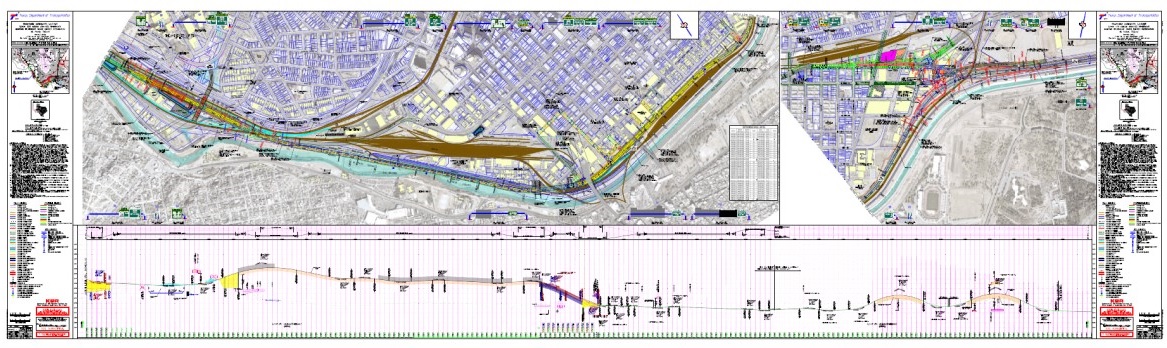
- LOOP 375 – BORDER HIGHWAY WEST TOLL ROAD - Racetrack Drive near Doniphan Road and New Mexico State Route 273, (Design Build)
Client: Abrams-Kiewit JV, (TxDOT El Paso District)
OMEGA developed a single comprehensive drainage study and PS&E drainage design for the 10-mile project. OMEGA performed all hydrology and hydraulics studies and drainage engineering for the project, including 10 bridge hydraulics studies, scour analysis for 10 bridges, 3 inline detention and 8 detention/mitigation facilities, analysis and layouts for 18 culverts, 10-miles of roadway storm sewer and bridge deck drainage, the design of Bottomless Arched Culverts to protect two waters of the US designated streams and FEMA floodplain mitigation.
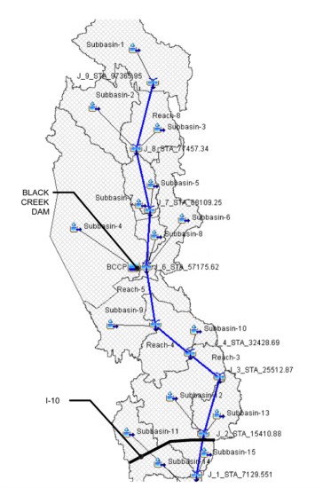
- BLACK CREEK COOLING DAM BREACH ANALYSIS, JACKSON COUNTY, MISSISSIPPI
Client: Thompson Engineers and Mississippi Power
OMEGA performed a Dam Breach analysis for the Black Creek Cooling Dam located in the East Central portion of Jackson County approximately 13-miles north of Pascagoula, Mississippi. The facilities consist of a cooling water reservoir, a gated spillway, and a bypass channel. The reservoir spillway is controlled with two independently operating hydraulic bascule gates. The main gate is 125-feet in length and the secondary gate is 25-feet. The spillway was designed to discharge approximately 77% of the 100-year storm flow at a maximum reservoir elevation. The remainder of the 100-year storm runoff is diverted to the bypass channel. The secondary gate is designed to provide a more accurate control of discharges during reservoir operation with its primary function being to pass flows during the design 10-year storm.
OMEGA evaluated the Black Creek Cooling Facility Dam for two scenarios: a Sunny Day Dam Break, and a Wet Weather Overtopping Dam Break. To determine runoff hydrograph shape and magnitude a HMS hydrologic model for the Black Creek Dam watershed was developed using the SCS Curve Number methodology to represent soil infiltration and loss rates. Initial estimates for parameters required for the hydrologic analysis were developed from available topographic mapping, aerial photography, land use mapping, and soils data. HEC-RAS was utilized in the creation of a hydraulic model representing the Black Creek Watershed. Topographic data for the spillway overbanks and Black Creek channel downstream of the spillway were developed from two-foot contour mapping provided by Jackson County and field surveys. Cross sections were then cut at approximately every 500-feet utilizing the ArcMap add in, GeoRAS. Three Bridges were surveyed and input into the hydraulic model. The model Calibration Method used PMP (probable maximum precipitation, 24-hour duration); provided by MDEQ and a Probable Maximum Flood (PMF) developed using HEC-HMS. The PMP depth was provided by MDEQ. Output flows from HMS were calculated and input into the RAS model. The RAS model was then run for its output flows at each cross section until values showed results less than 5% of its predecessor. The results routed flows from Cross Sections upstream of the dam to the outfall. USACE Geo-RAS application and ArcMap GIS software were utilized to post process the results of the HEC-RAS dam break analysis to develop approximate inundation boundaries for the Sunny Day Dam Break, PMF Dam Break, and PMF No-Dam Break scenarios.